Given that the last “beating” of the Cuxton Parish boundary took place in October 2018, I recently decided to undertake my own “perambulation” of the Cuxton parish boundary this year. In his book, “Cuxton: a Kentish Village”, local historian Derek Church described his own reconnaissance undertaken back in the early seventies, and I thought it would be interesting to see how things had changed.
 |
| Beating the Bounds - the party of 1957 at Whorne's Place... |
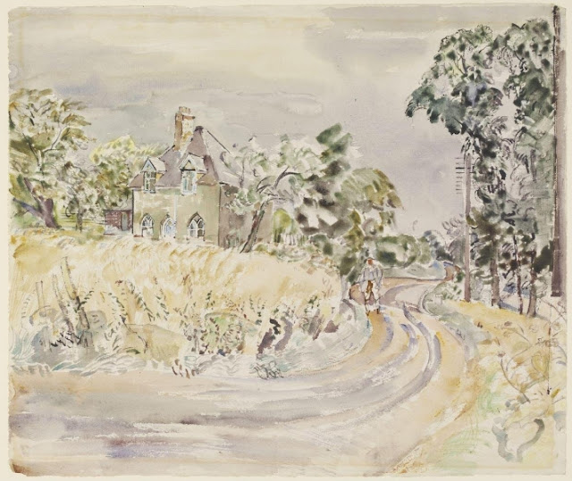
I started my journey at Whorne’s Place on the
| Marker at Whorne's Place, 1960... |
Crossing the road, I turned up the public footpath past Woodway Cottage and on towards the top of Church Hill. This is now a path fraught with some danger, as the adjacent field is often occupied by two particularly large black horses (and their offspring) of dubious temperament that have been known to kick or bite passers-by (as one unfortunate member of the Cuxton Countryside Group found out a few years back). Fortunately, most of the path now has a high chain-link fence protecting passers-by from unwanted equine attention. The last 200 yards or so are still only sectioned off with tape however and of course, the horses were present in this area but on this occasion they seemed to be well-behaved. Nevertheless, it was with a sense of relief that I reached the top of Church Hill and the farm gate stile.
The parish boundary itself runs through Bore’s Hole, the now-abandoned chalk pit that fed the Trenchman and Weekes cement works that used to be behind Whorne’s Place. The works shut down in the 1920s and the chimneys were demolished in 1951.

Trees do not make for enduring markers and indeed, the “huge beech tree just in May’s Wood above the pit edge” referred to by Mr. Church had long since gone. I found the first boundary marker tree further up, close to the junction with the path that leads down to the east of Dean Valley. The earliest date on it is 1990, suggesting that the original had indeed blown over in the storm of 1987.
| May's Wood, boundary marker tree... |
From there, I carried on along the track until it rejoined the main path. Interestingly, Derek Church notes an old yew tree mentioned as a boundary marker in 1796, located in “Warren Scrubs” and on the slope above Warren House just before the track rejoins the main path there are indeed several splendid old yew trees. Whether any of these are the 1796 one or not (or indeed, the same one that Derek Church recalls finding) is difficult to say. There is also a nice beech tree with them that would make a good boundary marker.
 |
| Ancient yew on the parish boundary, "Warren Scrubs"... |
After a short distance, just before the crossroads of the Warren Hill/Ridgeway/North Down’s Way tracks, the parish boundary dips down across
Derek Church gives the impression that it used to be possible to track directly across the valley, following the parish boundary directly into North Wood, but the valley has since been fenced off. I therefore carried on following the North Downs way that runs to the west of Dean Farm, crossing the valley and turning left (ducking under the chain) along the path westwards through North Wood. The Parish boundary intersects the westward track through North Wood at a point just after where the first set of overhead power lines cross – there is a pylon right by the track.
Mr. Church noted that there was a boundary-marking yew on the southern edge of North Wood bearing the markings “C 1957, 1966”. I did head east off of the main track in an attempt to find this and succeeded in getting to the boundary fence, but I could not find the tree mentioned. The area is pretty much overgrown with brambles and is not readily accessible.
Derek Church stated that “just to the west of the (main) track was a large hornbeam marked C 1948 and C 1966”. Exactly on the boundary (just to the west of the track as described) are the ruins of a big tree that looked like it had suffered a lightning strike and this may have been the tree that Mr. Church referred to. I certainly couldn’t find any mature hornbeams that are still standing in the area.
 |
| Burnt/dead tree, right on the parish boundary in North Wood... |
There is, however, a magnificent beech just to the east of the dead tree and it would be fitting to adopt this as a boundary marker in the absence of any others in the area.
 |
| Beech close to parish boundary, North Wood... |
Mr. Church says that he dropped down the slope from there to
the bottom of
The path through North Wood comes out close to the pylons. I
crossed under the overhead wires and then took the track off on the right which
leads down towards the public footpath NS214, which itself crosses the valley directly
up to Luddesdown. Instead of taking the NS214, however, I turned right, down
the farm track towards the bottom of
The Ordnance survey map shows a line of boundary stones
running along the southern edge of
 |
| Gate, bottom of Bush Valley on the parish boundary... |
The OS map indicates a marker stone here but I could not find it: perhaps it got grubbed up when the gate post was put in. Further up on the western side of the valley, I did succeed in finding another four marker stones, again all just inside the fence line. They are quite small (about six inches square and maybe nine inches tall) and are marked “HA” on the south-facing side.
 |
| Boundary marker stones, southern edge of Bush Valley... |
It’s worth noting that there are some concrete stones marked “H.A” (note the dot between the H and the A) further up the valley, towards White Pit in Halling. These are much larger than the parish boundary markers and are similar in style to the aforementioned Trenchman and Weekes stone up by Bores Hole. These latter stones are undoubtedly property boundary markers for Hilton and Anderson, the old cement company that used to work White Pit (hence the H.A) whereas the HA on the parish boundary markers probably just stands for HAlling, which shares the boundary with Cuxton at this point.
From the uppermost of the western marker stones, I scrambled eastwards up the bank through some scraggy brambles until I got onto the public footpath NS214, and then followed that up the hill into Bushy Wood. The NS214 meanders upwards and north-westwards for a bit and at a clearing by the junction of the Luddesdown-bound NS214 with a track leading northwards towards Clarkes Wood, I found a hornbeam that serves as another marker tree.
 |
| Bushy Wood - boundary marker Hornbeam with dates 1966 - 2018... |
This bore dates back to 1990 on one side, but on the other side the dates went back to 1966. Derek Church refers to a “hornbeam clearly marked C 1966” in the area and I think this must be the same tree.
Taking the northwards farm track from the junction, the row of large yew trees he also mentioned were evident, however, so I knew I must be on the right path.
 |
| Yews on parish boundary, Bushy Wood... |
The track opens out to a clearing above which the HV pylon cables run. Walking over to the edge of Clarke’s Wood, the path continues onwards. Once in the woods I followed the path downwards and then took a right turn just before the path dipped steeply, about 100 yards before what I think is one of the biggest beech trees I have ever seen. After a while, I found the large marker beech that I photographed on my 2018 tour.
 |
| Beech, boundary marker, Clarke's Wood... |
This is the only remaining “original” marker tree as far as I know, bearing dates right back to 1930. Derek Church refers to a tree marked in 1948, 1957 and 1966 that he could not find and I think this might be the tree he missed, although it does not have the 1966 date. The tree does lie somewhat to the east of the parish boundary and perhaps this is why Mr. Church (a keen scout leader with undoubtedly prodigious orienteering skills) missed it. (I cheat, by the way, and use a hand-held sat-nav…)
Mr. Church mentioned another beech in Clarke’s Wood marked “C 1966”, which suggests that the beech described above was missed out by the 1966 bound-beating team and another was marked up instead.
There are so many venerable beech trees in the area that I was satisfied to have found the one marker tree that I did, but I would need to do a more intensive search to find the “missing” 1966 tree, which I am sure is still there. Incidentally, there is a splendid old hornbeam just down the track from the marker beech tree that is much nearer the parish boundary and would make a good marker tree.I made my way northwards, passing a row of four yew trees that sit exactly on the parish boundary and also another large beech, unmarked, but again, right on the boundary.
 |
| Row of yews on parish boundary, border of Clarkes/Red Wood... |
Eventually the track leads out on to the field at the eastern edge of Red Wood, close to the parish boundary. Following the parish boundary northwards towards Warren House involved a short crossing over a newly-ploughed field, which, thanks to the recent wet weather, was extremely hard going.
 |
| View towards Warren House from the parish boundary at Red Wood... |
Eventually, and with about three inches of heavy brown mud clinging to the bottom of my boots, I made it to the green just below Warren House. In the past, it has been traditional for refreshments to be served to the perambulators at this point, but I had to make do with a quick swig from my water bottle to celebrate leaving Vineyard Farms’ land, before going through the little gate and starting up towards the railway tunnel I always call the “Icicle Arch”.
 |
| The "Icicle" arch, February 2021... |
Once through the tunnel, the old path that runs up the hill has long been fenced off for some reason and has become overgrown. Instead, I had to slog alongside it by walking through the long, wet grass at the edge of the adjacent field. Fortunately the barbed-wire fence at the top had fallen down and I was able to get on the Cobham track, dropping down the hill slightly and going through the Plotlands gate on the left. I headed up the hill again slightly before taking a track on the right, leading northwards up and across
I took a slight detour off the path eastwards towards the Plantlife gate where a sign says that they are allegedly re-establishing some “chalk grassland”. Nearby is a tree graveyard where several large beech trees have blown over, presumably in the great 1987 storm. One of these fallen trees was an original marker, now lying on its side with its roots forlornly levered out of the ground. Moss now obscures a lot of the dates on the stricken trunk and it is difficult to see how far back they go, though dates back to “1966” are visible.
 |
| Fallen beech marker tree, Plotlands. Another tree behind it has been adopted, as can be seen above... |
Derek Church refers to a tree in this area marked “C 1966” and I think the fallen tree must be the same one. There is a newly adopted beech tree right behind it though, bearing dates from 1990 onwards. Curiously, the most recent 2015 and 2018 perambulations have been missed out.
 |
| Beech marker on Plotlands, parish boundary... |
Returning to the main track, I continued up the hill. On the left in a clearing there is a single large beech, right on the parish boundary, bearing the Cuxton “C” and the dates 1983, 1985 and 2018. It seems the earlier tree down the hill is sometimes overlooked for some reason.
 |
| Beech, marker tree, Warren Plain... |
Derek Church mentioned a beech tree on Williams Hill that bore the markings “C 1966, C 1957 and C 1911”. I spent some time looking for such a tree but could not find it. Whether it still stands or was a victim of the 1987 storm, I don’t know.
Turning right up the track just inside the park fence leads to an old hornbeam located by a gate, which bears perambulation marks back to 1990. Again, this suggests a nearby marker tree had gone over in the ’87 storm.
 |
| Hornbeam, marker tree, Williams Hill... |
The track from William’s Hill eventually levels out just behind and to the east of the Mausoleum. Following the track eastwards that runs just outside of the Cobham park fence leads to the top edge of Birch Wood and (just down the hill a short way) the remains of the Toe Memorial (the story of which is told here). This stands very close to the south of the parish boundary and itself is a good “marker”.
Heading back up the hill and onto the main Cobham path, I did find a beech off the track on the left just before Five Throws corner, not marked with a “C” but bearing the year 2018, although this seems to be too far north (by about 120m) to be a boundary marker.
 |
| Beech, Cobham trail, marked 2018. Marker tree..? |
At Five Throws there is also another tree marked “C 1930” but with no other dates.
 |
| Hornbeam, Five Throws... |
Just to the east of Five Throws, the parish boundary comes up from the south-west to join the Cobham track for a while. There is a stand of hornbeams at this point, which looked rather splendid in their autumn colours, but are not marked in any way. Perhaps one of them should be.
Further down, there is a stand of chestnuts and hornbeams (again, unmarked) showing the place where the parish boundary leaves the Cobham trail and heads north-east to cross the A2.
At the junction of the main path by the footbridge and tunnel
to
 |
| Hornbeam, Albatross Way junction on Cobham trail... |
This tree stands about 100m east of the actual parish boundary, which by now follows the northern edge of the M2, across the A228 and down to the river.
I had no intention of crossing into darkest Strood to find out if the parish boundary could be tracked on that side. Instead, I followed the path next to high-speed railway track down the towards the Ranscombe reserve car park on Sundridge Hill.
I could have walked down to the main road and along to the business park, picking up the track that leads back under the bridge, around the back of the gypsy encampment and through the underpass back to the station. That, however, is quite a horrible walk, with much of the latter bit of that route obstructed by dumped rubbish and overgrown with brambles.
Given that (1) in reality, the parish boundary runs along the middle of the river from the A2 bridge until Whorne’s Place and (2), I was knackered, I satisfied myself with the view of the river as seen from Ranscombe just above the car park. I then headed to the White Hart via Longhoes, across the railway crossing and down Pebble Lane (just as Derek Church says he did fifty years ago) for a well-deserved pint or three, before completing the loop up Rochester Road to Whorne’s Place.
Although it actually lies some 320m to the north-west of the parish boundary (which, as mentioned earlier, lies in the middle of the river at this point) I have included the White Hart as the 30th and final point on my own personal list and map of 30 parish boundary markers, as not only is the building of considerable local historical interest, but it is also the place where all Cuxton Parish boundary perambulations normally finish – and no walking map is complete without a pub on it, in my own opinion!
 |
| The White Hart, now and 100 years ago: where all boundary perambulations finish... |
My FitBit gadget told me that I had completed 8.2 miles at this point, which had taken me around 8 hours, although I did spend a fair bit of time looking for markers that were hard to find, weren’t there or were hiding from me (not logged on the FitBit, which I paused when going “off-piste”…).
It is quite a slog, up and down the valley four times in all and over some quite tough terrain, but I reckon the “perambulation” could be comfortably done by a group in 5-6 hours.
As might be expected, things have obviously changed since Derek Church undertook his own parish boundary explorations in the late sixties/early seventies. Access to woodlands is harder as there are a lot more locked gates and barbed-wire fencing: it seems landowners are (understandably) getting more and more protective of their land. It also seems that a lot of the woodlands and paths in the "care" of Vineyard Farms Ltd. are being sadly neglected these days, as indeed is most of the land (including their vineyards) under their ownership. Many old trees were also lost in the great storm of October 1987.
There may also be more "modern" markers that I did not find, along with some older ones that may still be around but (so far) have eluded me. The parish boundary walk-around is nevertheless an interesting and enjoyable challenge, and I have no doubt that a "formal" perambulation will be organised soon.
References:
1) Cuxton: A Kentish Village by Derek Church (published by Arthur J Cassell Ltd, 1976, ISBN 0 903253 12 7), Chapter 2, pp 11-19.