Thursday, 4 April 2019

Upper Halling: Cottages, Courts and Farms...

OS map of 1938, showing detail of Upper Halling...

A walk southwards down Pilgrims Road in Halling takes you past Prings Cottage (2)  Parts of the Grade 2-listed timber-framed Wealden hall-style house date back to 1450 but it was allowed to fall into disrepair by the cement company that came to own it.  

Prings Cottage today...

Fortunately, in the 1960's, a private owner (a Mr. Arthur Harrison) bought and restored the cottage, much to his credit and to the benefit of our surroundings...

Newspaper clip, c.1964, about Mr. Harrison and Prings Cottage (credit Frank Smith)

Prings Cottage, 1959, before restoration

In the above photo, the timber frame of the original wall can be seen. A third bay of the cottage used to exist on the left-hand side of the cottage as viewed above, which was probably demolished around 1600.

Looking east from above Court Farm, 1955 and 1973...

The above pair of pictures show the countryside around Prings Cottage as it was before the extension of the Grey Pit chalk quarry up to just south of Pilgrims Road. The edge of the original quarry can just be seen on the far left of both pictures.

On early Ordnance Survey maps, Court Farm (1) is referred to as Upper Halling Court, but I believe this may be an error: from notes I have with the photo below, I think Upper Halling Court is the row of cottages that used to be further along Pilgrims Road.

The 1955 version of the picture above shows the old Upper Halling Court (3) on the left of the picture, down from Prings Cottage on the far right.  A larger building than Prings Cottage though of the same lineage, it was sub-divided into cottages (1-4 Pilgrims Road) which were sadly demolished in the late fifties. The footings can still just be seen in the 1973 view above.

Old Upper Halling Court, c.1947, before demolition...

Court Farm (1) is another place with a long history dating back to the fifteenth century, when it appears that the old Manor House (cited in many histories of Kent) was called "Langridge". The interior contains substantial remains of a timber-framed Elizabethan open hall house. A later brick-built wing was added at the southern end in the seventeenth century and incorporated part of the original hall house and gallery.

Court Farm, c.1900...

Old photographs show the outstanding feature of this "new" wing, a massive chimney stack topped with a set of four brick chimney shafts (Tinnoth House, at the other end of Pilgrims Road, has similar-looking chimneys, although this was a much later Lord Darnley build). Internally, this wing contained the remains of three fireplaces of moulded brick skimmed with mortar and ornamented, one having a typical Tudor four-centred arch.

Oddly, given its magnificence, this wing was eventually relegated to a store for farm equipment. The northern wing was probably not built at the same time, but appears to be a later copy of the southern wing. Early photos show the round type of oast in front of the building, these dating from 1839. 

View from above Court Farm, c.1920...

By 1966, the south wing had badly deteriorated and was in poor condition. The chimney shafts had already been partly demolished and the remainder of the stack was shored up. Two of the three round oasts had already been decapitated and were being used as stores.

The chimneys finally collapsed in 1973. In 1975, the Dutch Barn burned down. Further damage to outbuildings occurred during the Great Storm on 1987.

The present building has had much rebuilding, including restoration work after the chimney collapse in 1973.

View over Court Farm, c.1973: see c.1920 view above...

Court Farm, c.1973, same view as the c.1900 photograph above...

Court Farm, c.1973...

In 1840, title deeds show that a Mr. William Holding took over the tenancy of the farm. Around this time, between 1838-47, the property became known as Court Farm. 

Since 1871, Court Farm has been run by the Lingham family, who still farm the surrounding area today. Andrew Lingham also works closely with Plantlife, using his skills and unrivalled local knowledge to help maintain Ranscombe reserve over the hill in nearby Cuxton. Without the Linghams' involvement, I suspect the local countryside around Cuxton and Halling would look very different, and not for the better. 

Court Farm today...

The current farm shop opened in 2003, and has established a good reputation as a high-class butcher offering local and often farm-produced products. 

Update: On September 1st. 2021, the Cuxton Bakehouse moved their bakery operations to Court Farm, offering a local home delivery service (by bicycle!) for fresh-baked bread and cakes, with a small selection also available in the farm shop.

Tim Bedford, the Cuxton Bakehouse baker, at the door of his new premises on opening day...

Second Update: In April 2023 (after suitably cleaning up one of Andrew Linghams's old barns), the Moot microbrewery and tap room opened its doors to the thirsty of Upper Halling, who have had a 20 year wait to regain a local watering hole...

Team Moot (photo stolen from here...)

References:

Across the Low Meadow - A History of Halling in Kent, by Edward Gowers and Derek Church, 1979.

Tuesday, 2 April 2019

April showers...

Dodging the showers to get to Cuxton library, where the ornamental cherry is in full blossom...


Just at the entrance to library driveway, I noticed a pretty covering of Ivy-Leaved Toadflax...


The heavens opened just as I was walking through North Halling...


Monday, 1 April 2019

To Luddesdown Church...

The usual route from North Halling...

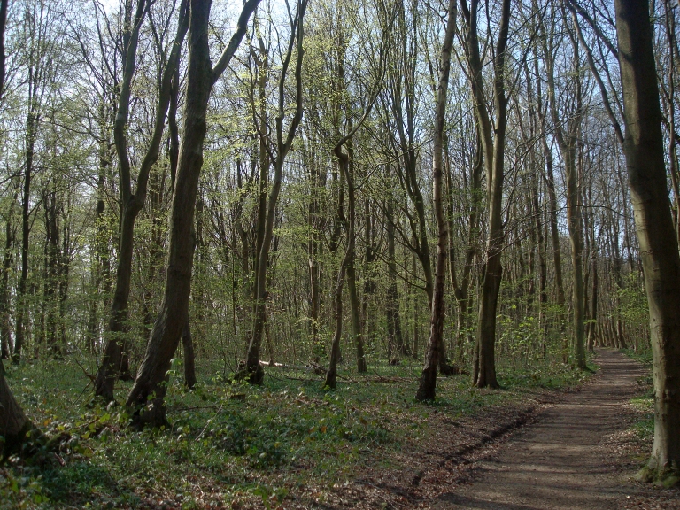
The woods are just starting to green up in the warm Spring sunshine...

Mays Wood

Wingate Wood

Wood Anenomes...

The deep ploughing of the fields for the planting of vines has started.  It is not pretty...

Luddesdown valley - view from Wrenches Shaw

Luddesdown Church looks rather splendid at this time of year...

Luddesdown Church...

Luddesdown Church...

Taken from the above web-page: "St Peter and St Paul is still a focal point of the scattered community of Luddesdown and its surroundings, little larger than it was when the Domesday surveyors of 1086 recorded 'a church here'."


"The history of Luddesdowne Church, post-Conquest, is poorly documented and has to be read against the fate of the Norman knights and their successors who acquired the manor. Following the church reforms of Henry III, many noblemen rebuilt their own small, cramped manorial churches, and this probably happened in Luddesdowne, where the earliest verifiable fabric, seen in the north and west walls, dates from the thirteenth century.

The tower and south aisle were then added in the 14th century, and so the church acquired the basic form in which it stands today. However, in 1865 the nave roof fell in requiring a major rebuilding. The reconstructed church was consecrated in 1867. Over the course of the next three decades the rector the Revd Alfred Wigan and his family furnished and decorated the church in accordance with their high church Oxford Movement tastes. Notably, they employed the firm of Heaton, Butler and Bayne to install stained glass windows and the fine set of wall and ceiling paintings which survive to this day.

Other historical features of note surviving in the church include a 14th century log ladder in the tower, three medieval bells, a 15th century brass, and a fine Caen stone reredos depicting the Last Supper installed in 1873 and designed by Ewan Christian."

I decided to walk back along Warren Road.  The venerable oak on the corner of the junction with Cobhambury Road has yet to strike leaf, but is surrounded by a carpet of yellow Celandines...


Oak, Warren Road


Celandines...

The hawthorns were in full blossom...


Hawthorns, Warren Road...

This young oak tree appears to be arising out of the ruins of its ancestor...


Dog Violets were putting up a good display nearby...


Dog Violets...

Tuesday, 12 March 2019

Upper Bush...


Upper Bush has its origins as a small hamlet that grew up on what is now the North Downs Way (then a well-used trade route) during the medieval period. There is no separate reference to the hamlet in the Domesday book.

North Downs Way signpost

The first recorded mention of the settlement is in 1320 when the then bishop of Rochester, Hamo de Hythe, is recorded as visiting the manor of Cuxton and holding court in the Chapel at Birch. The exact site of the medieval chapel is not known, but a chapel did persist at Upper Bush until the sixties, when the by-then disused Hope Chapel was finally demolished.

By the late medieval period Upper Bush had grown, with the building of at least two substantial timber-framed structures, High Birch and Borrow Hill House, the latter dating back to 1390. Upper Bush Farmhouse, which stood to the west of the settlement, is also likely to have had a medieval origin. 

It is unclear whether there were other, less substantial, medieval dwellings on the site. The hamlet formerly formed part of the Cobham estate of the Darnley family. It appears to have been a relatively late acquisition, with the majority of the land being added to the estate between 1797 and 1842 and further properties being added during the latter 19th century.

Upper Bush, 2019...

Before 1797 Upper Bush was part of Lord Romney’s Estate in Cuxton. Ownership of the Upper Bush before this date is unclear. It may once have formed part of the manor of Cuxton, which was held by the Bishop of Rochester in the medieval period, and passed to the Dean and Chapter of Rochester Cathedral after the reformation. However, it is not mentioned in a survey of the manor undertaken in 1649 and it is possible that the hamlet originally formed part of the Whorne’s Place estate, which had been held by ancestors of Lord Romney since the 15th century. Upper Bush had developed into a thriving agricultural settlement by the 1840s.

1869 OS Map showing Upper Bush. At this time it was a larger village than nearby Cuxton...

Upper Bush from Barrow Hill, c.1910...

Upper Bush, c.1910....

Detail from above photo: this pair of cottages was demolished in the mid-sixties

Upper Bush Farm, c. 1947...

Upper Bush, 1963...

The principal farmstead by this time was Upper Bush Farm House, which featured a pair of cottages, large barn, outbuildings and a cart shed. 

Upper Bush Farmhouse, c.1912 (now demolished)...

A further large house was situated to the North West. Smaller cottages were grouped around the green. These were generally small yellow brick or weather-boarded buildings. High Birch and Borrow Hill house were both divided into three cottages by this time.  For some reason, the three cottages of Borrow Hill House were known as "Clack Alley".

"Clack Alley", c 1904....

Borrow Hill House, just after restoration, 1971...

Further development in the second half of the 19th century resulted in the rebuilding of the farm buildings of Upper Bush Farm, including new barns and an oast house along with the demolition of earlier barns and cottages. 

Barn, Upper Bush 1972, (now demolished).  The oast houses (also gone) were adjacent to this barn.

Additional cottages and the non-conformist Hope Chapel were also built along the south side of the green, alongside the track that now leads to the farm buildings. The bungalows at the entrance to the conservation area were added in 1923.

Hope Chapel, Upper Bush, c.1950 (now demolished)...

Upper Bush reached its largest extent just before the Second World War, when it contained 22 houses, an off-licence and a baker.

The Old Bakery, 2019...

During this time, the Old Bakery appears to have been at the heart of the village as it featured a bakehouse, brewhouse, flour store and off license to the rear, much of this incorporated in a now demolished extension. 

Bush Bakery, c.1900, with Mr. Henry Baker...

Bush Bakery, 1931...

The Old Bakery, 1973...

The rear of the Bakery, c.1900, with Henry Baker, Percy Wood (holding "Spider") and Albert Baker.

The rear of the Old Bakery, 1973...

Upper Bush was transformed shortly after World War II when the Cobham Estate was acquired by the City of Rochester.

Borrow Hill House, 2019...

In 1960, Strood Rural District Council decided (with typical municipal small-mindedness) to clear what was then considered sub-standard housing in the hamlet. This left only five buildings standing and involved the demolition of several historic buildings including Upper Bush Farmhouse. 

Upper Bush Cottage, 19th April 1913, with Mrs. Sally Bonneywell and her grand-daughter...

It was originally planned to demolish Borrow Hill House and High Birch but a campaign organised by local people led to the recognition of the historic worth and restoration of these buildings. The only modern structures to be erected recently are a group of barns at Upper Bush Farm, although High Birch has just recently developed an outbuilding as a rather nice holiday let...

High Birch, 2019...

Conservation Area status was granted to the area of Upper Bush in 1994.  One can only hope that this protects it from the greed and rapacity of developers in the future.  Historic Upper Bush and its surrounding countryside are among the last remaining green belt areas in the Medway Towns. It is a wonderful, beautiful, peaceful place.  I hope it remains that way...

"I cannot begin to imagine what goes through the minds of councillors who can destroy such a place of beauty...": Derek Church, Cuxton - A Kentish Village, 1976.

Update (June 2021) - no such luck...

References:

1)  Cuxton: A Kentish Village by Derek Church (published by Arthur J Cassell Ltd, 1976, ISBN 0 903253 12 7), Chapter 6, pp 78-91.

2)  Upper Bush Conservation Area Appraisal, Medway Council (PDF file, link here).  

Tuesday, 5 March 2019

Brockles...

A fine March morning for a walk up to Brockles via Southern Fields (see map)...

Southern Fields looking towards Bishops Wood

The blue blooms of Slender Speedwell are abundant and add welcome touch of colour at this time of year...

Slender Speedwell...

Walking through the small patch of woodland that is Bishops Wood brings you out into Kitchen Field. Turning left and climbing the hill with Bishops Wood on your left brings you out into Brockles...

Catkins...
Looking west towards Cobham and Luddesdown...
Looking south-east towards Cuxton...
Towards Upper Bush...

Thursday, 21 February 2019

The Grapes of Wealth...


Luddesdown from Wrenches Shaw, late evening - enjoy while you can?

Towards Cobham from Wrenches Shaw - late evening:  Enjoy while you can?

A while back, I found out that much of the farmland around Luddesdown had been put up for sale.  This area is one of the few remaining unspoiled areas of North Kent, offering spectacular views of the seasonal changes of a classic English North Downs agrarian landscape. 

Naturally enough, this has caused some unease in the local community. Very little of North Kent has managed to avoid the rapacity of greedy developers, and the merest thought of Luddesdowne vanishing under yet more high-density, low-cost/quality housing for London refugees is too horrible to contemplate.

So today, I set out to the Golden Lion in Luddesdown, to attend a public meeting with the new owners of Court Farm and Brookers Farm. These arable farms are archetypal English farmland and have remained pretty much unchanged in character for the last hundred years, and contribute so much to the beauty of the area.

To be honest, I had been half-expecting to have to listen to some stuffed suits explaining how the new overseas owners had added Luddesdown to their land investment portofolio and had no present plans to significantly change blah blah blah - other than putting up lots of barbed wire and making public access difficult a la Church Hill in Cuxton (as foreign owners of English land so often do...).

Instead, the “new owners”, Holly and Neil, turned out to be a very pleasant and very English young married couple. Holly (rather nervously) took the microphone to explain her background to the sixty or so people packing the Golden Lion bar, before outlining their ambitions to turn the area into an eco-friendly vineyard.

Holly is the eldest daughter of the entrepreneur Mark Dixon, the colourful Monaco-based English billionaire businessman best known as the founder of serviced office business Regus.

Mr Dixon himself is no stranger to the vineyard business, already owning the Chateau de Berne vineyard and spa complex in Provence and the Kingscote estate in Sussex, and has undoubtedly provided the financial backing for his daughter and son-in-law to develop Court and Brookers Farm, although not necessarily along the same lines.

In terms of local employment opportunities, they will certainly be created.  Whether anyone local has what's needed for starting and running a vineyard is debatable.  In conversation with their business manager (a forthright lady whose name I forgot to ask), it seems that the initial start-up crew (40-odd strong) will be itinerant in nature, and will be hired in and housed in a temporary camp site for the duration of the initial vine planting.

Quite what the effect of all this upon Luddesdown and its surrounding countryside remains to be seen. A vineyard and bottling plant (and, I suspect, the inevitable spa/hotel/conference centre) will undoubtedly increase the amount of traffic down the narrow country lanes around Luddesdown.  

And replacing the annual cereal crops with permanent vines will inevitably mean an end to the glorious and colourful ever-changing seasonal views across the valley. The green fields will no longer undulate gently in the valley breezes as they turn to gold in the summer. The spectacular wildflower vistas of blues, reds, yellows and whites that once flourished amongst the oats and barley will be lost in the monoculture of the vineyard.  Better than a sea of houses, though...

Sadly, the view itself from Wrenches Shaw may well be lost should the vines be strung up the hill from the east of Cutter Ridge Road.  Two metre-high vine canes would effectively fence off the view from Bassett’s Seat with a wall of vines. 

Holly and Neil seem like very likeable and I really wish them all the best. They genuinely seem as if they want to preserve the character of the area as far as they can. I just hope that they can find the time to walk the paths around their land, and in particular, to take in the view of their land from Ray and Eiley Bassett’s memorial bench up on Wrenches Shaw, before it all gets blanketed under vine poles.

And to reflect upon what they hold in their hands.

It would be a tragedy if that view were to be blotted out by the dull, dreary monoculure of vines.

But at the end of the day, change happens. We can all be thankful that as changes go, a new vineyard springing up on the landscape is not a disaster, just something different...